Yes, Charlotte’s a city on the rise with award winning food, a blossoming craft beer scene, and some super cool music venues (looking at you Evening Muse!).
But it’s also in the center of some of the most amazing hiking adventures in the Southeast.
Don’t believe me?
Stroll the high-mountain balds of Roan in fall, when your unobstructed view captures the multicolored valley floor (it’s an easy 2.5 hour drive from the city).
In fact, here are five epic hikes you can try, all doable as a day trip from the Queen City.
Roan Mountain Highlands, TN/NC Border
Why is it epic?
The Roan Mountain Highlands are a series of balds that straddle the NC / TN state line. Each bald rises over 5,000 feet, offering incredible 360 degree views to the valley below.
The hike rambles over these balds, following a piece of the Appalachian Trail that’s often considered one of the most stunning sections of its nearly 2,200 miles.
There’s no bad season to take this hike on, but mid-fall and late spring are standouts. Fall brings a multi-color carpet to the valleys and in June, the flame azaleas and rhododendron light the balds on fire.
How do I do it?
There are no loops available, but there are two popular ways to tackle this section of trail.
Option 1: A 14-mile one-way hike with car drop.
Drop a car at Carvers Gap.
Drive back down the mountain and park on the side of Bear Branch Road, about one mile west of the NC / TN state line off of Highway 19 E. (Bear Branch Road is a few hundred feed from the Mountain Harbor Bed and Breakfast).
Look for the AT trailhead on the other side of 19E, then simply follow the AT for 14 blissful, if quad-burning, miles.
You’ll end at Carvers Gap.
Option 2: An out and back, whatever distance you like
Park at Carvers Gap and head towards the first bald. It’s tough to miss.
The first three miles covers the first three balds, so you can have a fantastic 6-mile out and back from Carvers Gap. Note that if you go beyond those three balds, you’ll drop steeply into a forested valley. Still beautiful, but it’s a tough hike back out.
Grandfather Mountain, NC
Why is it epic?
Grandfather Mountain State Park has some of the most rugged and varied treks in the Southeastern U.S. Expect to amble through dense forest, scramble over exposed rock, cable-pull up steep inclines, and climb ladders bolted into the mountain.
It’s challenging, exhausting, and a bit nerve-wracking. But it’s never boring.
Two specific highlights on this hike are MacRae’s Peak and the Mile High Swinging Bridge. The former is a huge rock outcropping accessible only by ladder (and a perfect lunch spot). The latter is the big attraction at the “touristy” side of Grandfather and well worth a visit.
How do I do it?
There is a charge to enter Grandfather Mountain State Park at its main entrance. Don’t go there.
Instead, you can hike in from either the Profile Trail to the north or the from the Boone Fork Trail to the east. Both are excellent hikes with plenty of challenge and variety.
Profile Trail entrance: Highway 105, about a half mile from the Banner Elk Lowes Foods and ABC store.
Boone Fork Trail entrance: Mile marker 299.5 on the Blue Ridge Parkway.
Each option eventually joins the Grandfather trail which, in turn, leads you to the main visitor parking lot, Mile High Swinging Bridge, and a small shop with trinkets and snacks.
Round trip these hikes are roughly 13 miles. But they are slow miles, so add a couple hours to your typical 13-mile pace.
Jone’s Gap, SC
Why is it Epic?
Jones Gap State Park is one of two parks in the Mountain Bridge Wilderness Area, a natural boundary between the Blue Ridge Mountains and the flatter Carolina Piedmont. Lots of rain falls here and, when coupled with the sudden loss of elevation, it creates a stunning collection of waterfalls.
From the Jones Gap State Park “side” (trails connect it to Caesars Head State Park) it’s easy to reach two quality waterfalls in a relatively short hike: Rainbow Falls and Jones Gap Falls.
How do I do it?
Start at the Jones Gap State Park main parking lot (note there’s a fee of $5/adult) and head out on the main trail (#1 on the map). Follow it about one mile to a right turn off for Rainbow Falls. This is a great spot for lunch, especially in summer as the falls create natural air conditioning.
Head back to the main trail and continue another mile until you reach the turn off for Jones Gap Falls.
After you’ve had your fill of falls, head back the way you came on the main trail.
Linville Gorge, NC
Why is it epic?
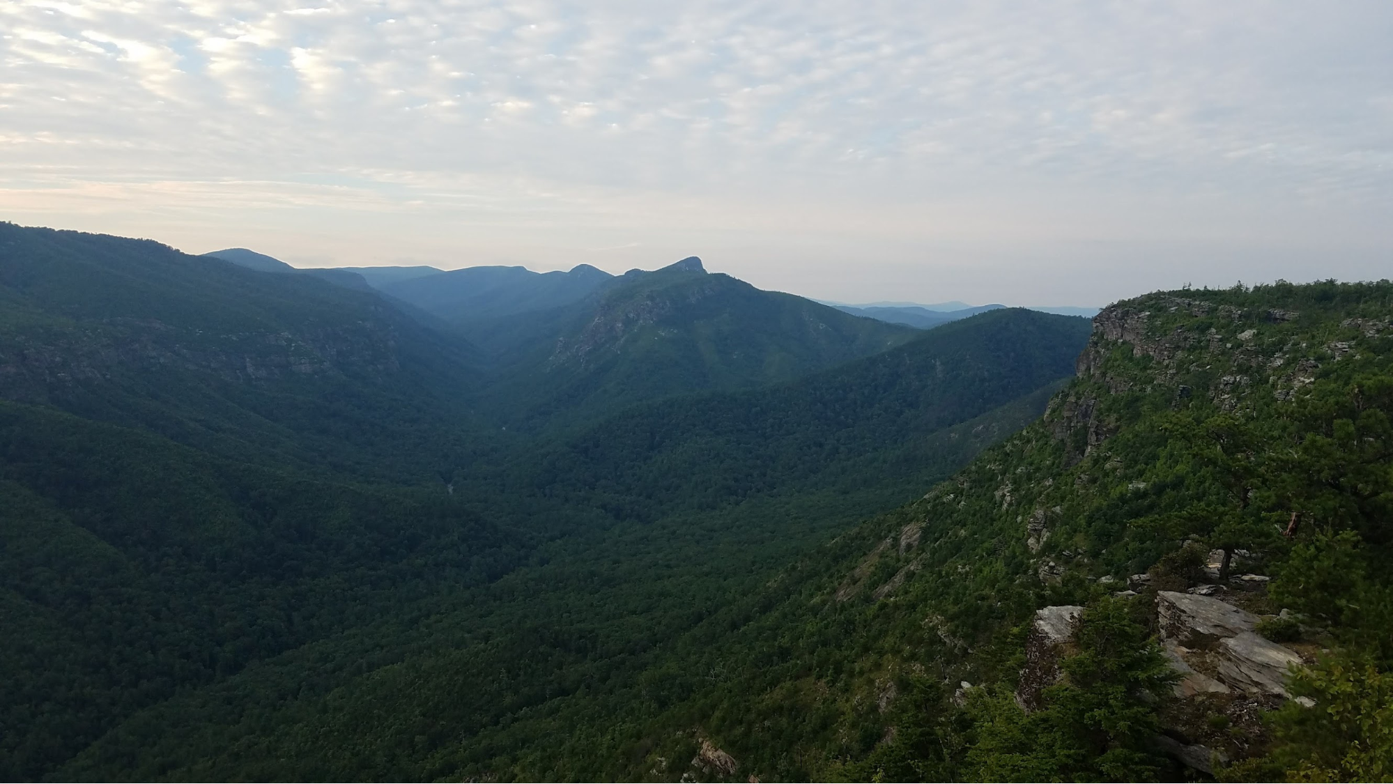
Linville Gorge is a 12-mile, up-to 2,000 foot-deep canyon smack in the middle of Pisgah Forest. The Gorge, North Carolina’s heavily forested answer to the Grand Canyon, is the result of millenia worth of carving by the river of the same name.
For us hikers, it’s a stunningly beautiful, rugged, rocky, wilderness with roiling rapids coursing through its depths and outcroppings carved of shear rock at it’s rim.
The Mountains to Sea Trail runs along the eastern edge of the gorge, creating a spine for the trail system on this side of the canyon.
How do I do it?
The trailhead at Wolf Pit Road is an easy access point towards the southern end of the gorge. It’s just 1.5 hours from Charlotte and there’s usually enough parking here, if you’re creative.
Jump on the trail at the end of the parking area and follow it uphill for about a mile. You’ll take a right (north) on the MST and follow it for another 4 miles.
Along the way you’ll have several opportunities to grab views of the gorge and scope out the spacious campsites for future backpack trips as well.
At the 4 mile mark you can turn left down the rugged and steep Cambric Trail, continue straight for more views, or simply turn around for a 10-mile out-and-back.
Note: The Cambric Trail is no joke. It’s less than a 1.5 miles to the river, but can easily take an hour to get down and two to return.
Mt Rogers / Grayson Highlands, VA
Photo credit: Donna Beige
What makes it Epic?
This out-and-back hike leads to the highest point in the state of Virginia
And few people really care.
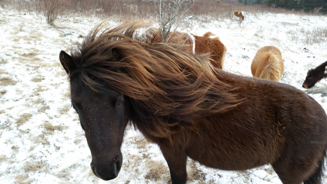
Why? Because the real highlights of hiking the adjacent Mt Rogers and Grayson Highlands State Parks are the ponies the and the otherworldly rock formations.
The “ponies” are actually free-range, half-size horses that typically wander the meadows of Massie Gap, about five minutes into your hike. They were introduced to the area in 1974 as a eco-friendly way to keep the balds bald. They’re not terribly shy and typically up for a good photo shoot. But you are encouraged to look, not touch for their safety.
The rock formations appear to burst out of the rounded hills, making the area just past Massies Gap look more like the Scottish Highlands than southern Virginia.
After all that, you will reach the highest point in Virginia. The small geological marker disc, planted in a rock surrounded by trees, will tell you. You’ll probably take a picture, but you’ll be looking forward to the hike back with another peek at the views and the ponies.
How do I do it?
Start at the Massie Gap parking lot in Grayson Highlands State Park. Take the Rhododendron Trail up to the Appalachian Trail and take a left.
Follow the A.T. until you see the Mount Rogers Summit Trail on the right. Follow that trail to the top and poke around the forest for the high-point marker. Turn around, and head back to the parking lot.
The total out-and-back is about nine miles.


